
Earlier this year, whilst Rowan was off gallivanting with his Anma and Grandpa, Rick and I decided to go for a big walk. Rick had always fancied climbing Helvellyn, preferably by the edges, but we were taking Rocky and Pebble with us. A few years back, during a walk by a local canal, they had both fallen in, so Striding Edge was deemed to be just n0t suitable for our giddy furry pair. Instead, we decided walk the Helvellyn range, south to north for a brilliant high level walk.
We parked up at Ullswater Steamers (rough postcode CA11 0US) and walked back to the A592, calling at the toilets along the way. Once in Glenridding, we turned left at Sharman’s Convenience Store and made our way along a road, which soon turned into a wide track, until we reached a signpost indicating the way to Lanty’s Tarn. We turned left and upon coming to another sign, we ventured into the trees.


The stone path meandered steadily upwards through the trees, the air cool and calm, until we came back out into the open and bright sunshine. Our path led steeply through a field of bracken, where me and Rocky wondered whether we could get through without picking up any little bloodsucking hitchhikers.


It was a hot day and I was finding it particularly hard work, but views across to Sheffield Pike more than made up for the effort required.


After a short while, we reached the tranquil pool of Lanty’s Tarn. We were tempted to stop for a break, but with a long day ahead planned, we continued onwards.
Surprisingly, there was no one on the path with us. I guessed that a lot of people would have been taking advantage of the dry, still weather to traverse the exhilarating Striding Edge. We took this opportunity to give Rocky and Pebble some rare off lead time, and they loved running around through the grass. Ahead, we could see the crags of the east face of Dollywagon Pike, our first Wainwright of the day.


And looking back down the valley, we could see Place Fell – a future walk for Rowan I think.


Grisedale is a beautiful valley, and so green! We walked along a mostly level track for around a mile and a half, taking in the views and feeling the sun on our faces. Eventually, as we passed through another gate, the landscape became hummocky, and the path began to rise – the scene ahead reminding us that the valley in which we stood was once carved out by a glacier.

As we climbed further, we crossed a bridge, passing becks tumbling down from the coves above and as the skyline approached, imposing cliffs towered above us.


Eventually, we reached the crest of the path and were met with the atmospheric Grisedale Tarn. Surrounded on three side by Fairfield, Seat Sandal and Dollywagon Pike, the tarn is believed to be the final resting place of the crown of Dunmail, the last King of Cumbria.
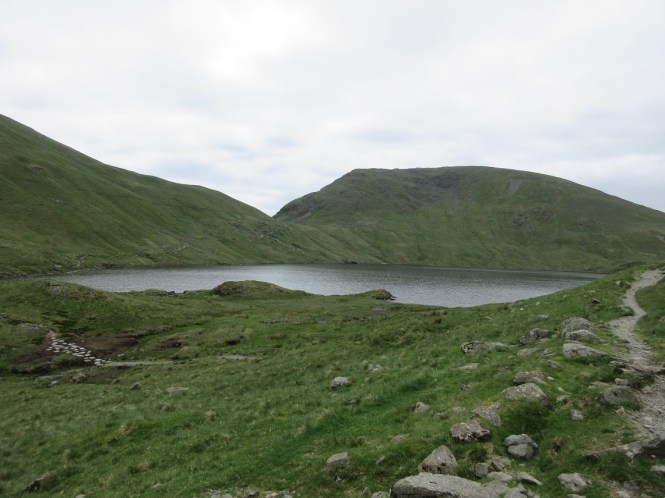
The crown was said to have magical properties, bestowing the wearer with the right to rule Cumbria. Around 945 AD, a battle was fought between the Cumbrian troops and their king, Dunmail and the forces of the Saxon King Edmund. King Dunmail was slain in battle, and his surviving men were forced to build a stone cairn over his body where he fell. This alleged cairn still stands today, giving rise to the name of the pass on the A591 – Dunmail Raise. Whilst involved in the task of burying their king, a handful of loyal followers stole Dunmail’s crown, throwing it into Grisedale Tarn until a king was ready to return and reclaim his lands.
We had our sandwiches overlooking the lake, wondering if a crown may be found in its depths, before heading alongside the right hand side of the water to the zigzag path leading up the steep slope towards the summit of Dollywagon Pike. Despite having refuelled, I found this part of the walk particularly tough – at one point sitting down at the side of the path, admiring the view of the lake and dramatically declaring to Rick that I didn’t think I could do it today. But I soldiered on and managed to get my second wind, though I couldn’t tell you where I found it (I think Pebble may have actually dragged me up).


After a hot slog, the path, thankfully, began to level out and we walked along a wide clear path to a post. The central fells had now come into view as clouds began to gather overhead.

Turning right at the post, we left the path and walked up a gentle slope to the summit cairn of Dollywagon Pike – our first Wainwright of the day. Beyond the cairn, we could see all the way down the valley we had just walked, with Place Fell standing at the end overlooking Ullswater. To our right was the steep cliffs and gullies of St Sunday Crag.


As we looked to our left, we could see the route for this rest of the day. It was now Rick’s turn to deflate slightly. He thought the ascent for the day was done. He was wrong.
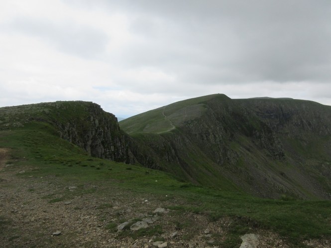
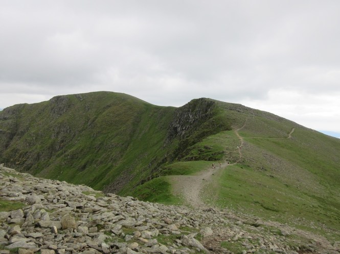
He was ready to continue much quicker than I had been though, and we walked along the top of the crags above Ruthwaite Cove to High Crag. High Crag isn’t a Wainwright, but it still affords glorious views (including a glimpse of up route up to Striding Edge) and the summit, with its up-thrusting rocks made for an interesting top.


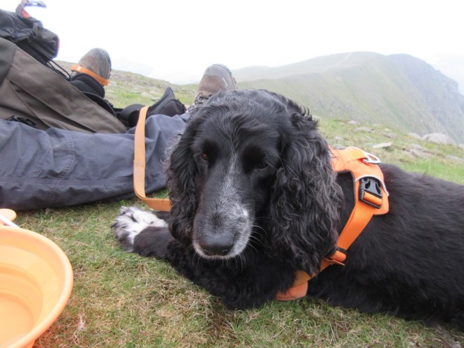
From here, it was a simple stroll along a clear path to Nethermost Pike. Despite the clouds, it was still pretty warm, so the muttlers had some water, perfecting their drinking from a bladder techniques.


It wasn’t long before we reached the broad grassy top of Nethermost Pike. Looking back was the steep cliff which led to the summit of High Crag, and beyond, Dollywagon Pike.


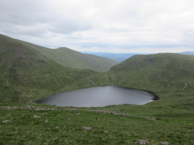
Our day was not over though. Helvellyn was our next target – a walk of under a mile along an easy path with the dogs leading the way. And now we could clearly see why it was not a good idea to take our furry pair across Striding Edge with its steep sides plunging into Nethermost Cove below.


Along the way to the summit, we passed a Herdwick sheep guarding her patch of grass, completely unphased by our presence. There was a plaque commemorating a 1926 plane landing of the summit of Helvellyn. The two seater plane landed and “after a short stay”, returned to Woodford Aerodrome near Manchester. We also could look down into Red Tarn, flanked either side by Striding Edge and Swirral Edge.


The top of Helvellyn is topped with a summit cairn and triangulation point, with the conical peak of Catstyecam standing proud in the background.


We weren’t the only visitors to the summit of Helvellyn however. There was also an influx of little flies, seemingly determined to make their home in Rick’s beard, so we didn’t linger. We descended down to Helvellyn Lower Man and had our second dinner, with views of Swirral Edge behind us and the lake of Thirlmere ahead of us – the ever hopeful Rocky spending more time looking for treats.


As we sat enjoying a cup of the best brew ever – flask coffee on a mountain – we noticed that the clouds were beginning to come down, and it wasn’t long before we were enveloped in mist. With that and the temperature dropping, we donned our coats and quickly revised our walk. We had originally planned to continue across White Side and on to Raise before descending back via Sticks Pass. Instead, we decided to cut the walk short passing over White Side to descend towards Keppel Cove and back to Glenridding.


After a fairly steep descent, we made a gentle re-ascent to the top of White Side. In his guide, Wainwright said that “the panorama is very good” and that “the best picture is provided by Skiddaw, with Bassenthwaite Lake at its foot”. We’d have to take his word for it as visibility was down to around 15 metres, though we did manage to find the summit cairn.

The path from the top was clear and well cairned, but I was glad I was booked onto a navigation course in the next few weeks. The day had shown how easily the weather could change, and I was looking forward to refreshing my navigation knowledge. But for the meantime, I checked the map and saw from the contours that we should come to a path that peeled off to the right to head down into the valley before we would start climbing again. Despite the poor visibility though, the fork was obvious when we reached it, and we began our descent.


Our new route towards Glenridding Common led us along an easy gradient and pleasant underfoot. On the way down, Pebble spotted some sheep on the path ahead on us and we noticed a violet ground beetle (I think) scurrying across and path. As we reached the steeper zigzags that would lead us ever closer to Glenridding, the cloud still clung eerily to the crags above us.


Once we reached the bottom of the zigzags, the gradient became easier again, and we enjoyed a stroll down the valley until, after around a mile, we reached a bridge crossing Swart Beck and past by a number a buildings.


From here, we followed a road, past a youth hostel, until we reached a gate on our right, signposted Gillside


Passing through, we followed a grassy path down to a footbridge over Glenridding Beck.


Looking up the beck, we were treated to a lovely view of our walk, cloud still concealing the tops. Looking in the direction of Ullswater, we could see the steep grassy slopes of Glenridding Dodd.


From here, it was around a mile of easy walking, past Gillside Campsite, back to the car park and a well-earned rest for two tired pups and their equally tired Mum and Dad. We had walked around 12.5 miles and climbed roughly 1,500 metres and it had been excellent, despite my wobbly legs at the first sign of a steeper path. If you like the look of this walk, you can find a map here – maybe you’ll get that view from White Side.
![]()

I love waking up to one of your posts, grabbing a brew and sitting down to read it. Pictures are awesome as always
Andrea x
LikeLiked by 1 person
Thanks Andrea. Been a bit slow getting things written up recently, but I’m better there. Really glad you enjoy it. xx
LikeLike
Stunning scenery #adventurecalling@_karendennis
LikeLiked by 1 person
Absolutely beautiful. I love how much it changes with the weather too.
LikeLike
What a great journey – thanks for taking me there! The Lake District is remarkably beautiful; it’s somewhere that I have always wanted to explore but never quite got round to it. That said, I did actually stay at that Youth Hostel once, en-route to Scotland. I had wanted to get up early and run up Helvellyn before leaving (I was fitter then…) but the weather was abysmal and I had to cancel. Next time!
Greetings from Luxembourg! #AdventureCalling
LikeLiked by 1 person
Hello to you 😊
I love the Lakes. Such an amazing place. I quite fancy a stay in the Youth hostel. Don’t know if I’d manage to run up Helvellyn though. 😃
LikeLike
Fantastic route. I was recently on Place Fell, which has a great view into the heart of the Helvellyn range. I’d never thought of going up there but definitely recommend it!
LikeLiked by 1 person
Ooo, thank you. That could be a good one to do with the boy too. He really has his mountain legs now 😃
LikeLike
A great walk and fabulous images to accompany it! I haven’t walked the area for a number of years, but it certainly brought back some memories. Gareth #AdventureCalling
LikeLiked by 1 person
Aw, thank you. It’s a gorgeous place isn’t it. Could never tire of it.
LikeLike
Looks like a great walk, and similar to one we did a few years ago. We too had even worse weather and never got any decent views-we really need to go back in the summer and try again! It’s such a beautiful part of the world, we’re heading back next April so might see if we can manage a child free adventure. #AdventureCalling
LikeLiked by 1 person
Good reeading your post
LikeLiked by 1 person
Thanks Shannon 😊
LikeLike