
During the October half term holidays, we had a plan to get up early and head to the Pen-y-Pass car park on Snowdon. We were going to take in the lakes along the Miner’s Track, have a picnic and head back, dependant on how far Rowan’s legs fancied walking. We knew we would have to get up early as the car park fills up quickly, but knowing, 1. How popular a walk Snowdon is and 2. How rubbish we are at getting up super early, we had a plan B. Now there is the option of the Snowdon Sherpa, a bus that can take you from other car parks and villages round the foot of Snowdon to the Pen-y-Pass, but the thought of taking our ruffing furry pair on a bus wasn’t appealing. When we arrived at the car park, nowhere near early enough, plan B – the Watkin Path, was put into action.
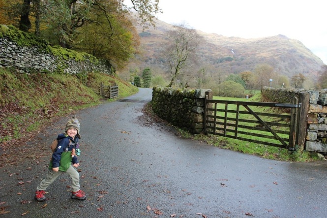
Turning the car round, we head down the road towards Beddgelert and pulled into a much emptier car park on the A498. After the usual toilet visits and with boots and rucksack on, we set off. The Watkin Path was created by Edwin Watkin, a retired MP who extended that path that had ended at South Snowdown Slate works to the summit, so that people could enjoy a walk to the top of Snowdon.
After crossing the road, my navigation skills were called into question immediately. We were presented with two possible routes – one up through the woods, signposted the Watkin Path but not marked on the map, and another along a single track road. After a bit of deliberation and wondering whether I needed glasses, we were helped out by a friendly passer-by. Apparently the forest path was relatively new, and the road did indeed lead to the Watkin Path. We were on our way.
We walked alongside the woods and behind us were beautiful mountain and woodland views. I suspect that the path through the woods meets up with the path we were on further up, and would have been a nice start to the walk in a different way as being amongst the trees is always lovely. I don’t know much of the views we would have seen though.

Eventually, our route became rockier but still easy underfoot. Everywhere was green – the dry stone walls and tree trunks were covered in moss, ferns and vines growing seemingly out of the slate – and it was so peaceful.


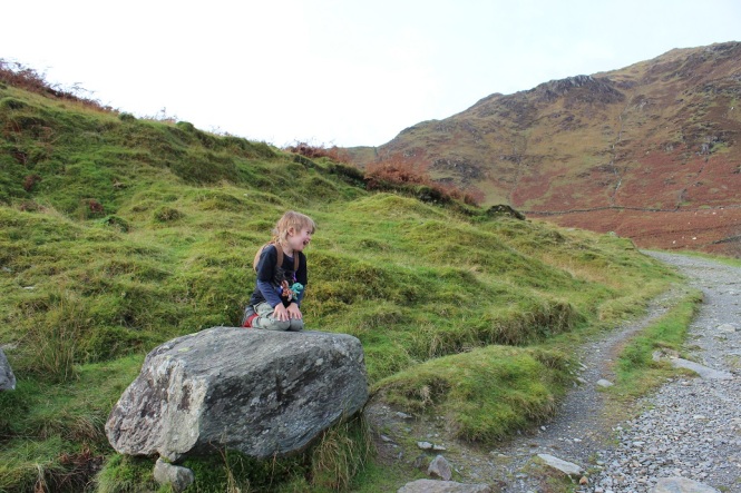
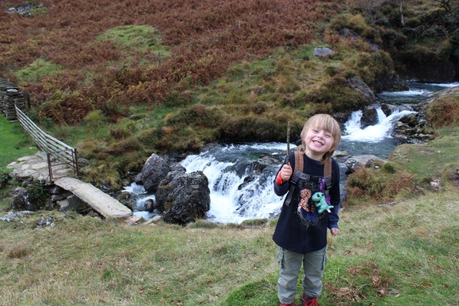
As the rocky track bent round, it gave way to a gravel path and the mountain scenery opened up before us. I was already really enjoying our plan B. Rowan spotted some rocky knolls just asking to be climbed, so off he went. Everything is for climbing at the moment and he’s getting more and more confident. There’s just so much to explore outside.


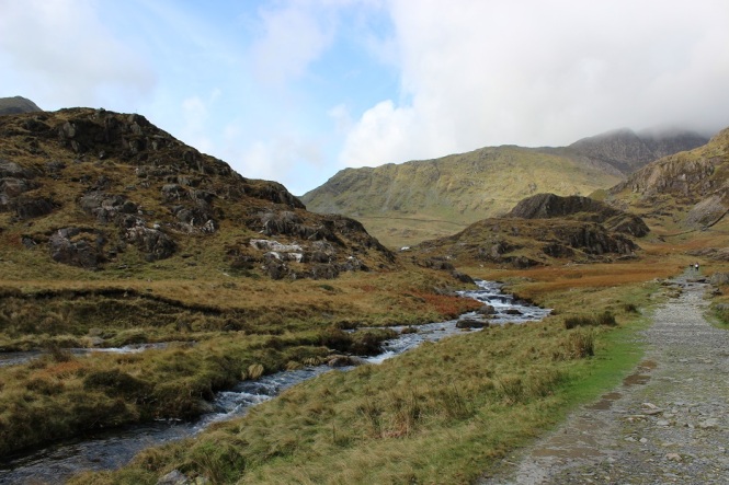
The path snaked round, climbing so slightly it was barely noticeable, and with each bend we were treated to a slightly different view, or rock to climb.


Looking back we could see Afon Cwm Llan rushing and winding its way to the valley bottom.
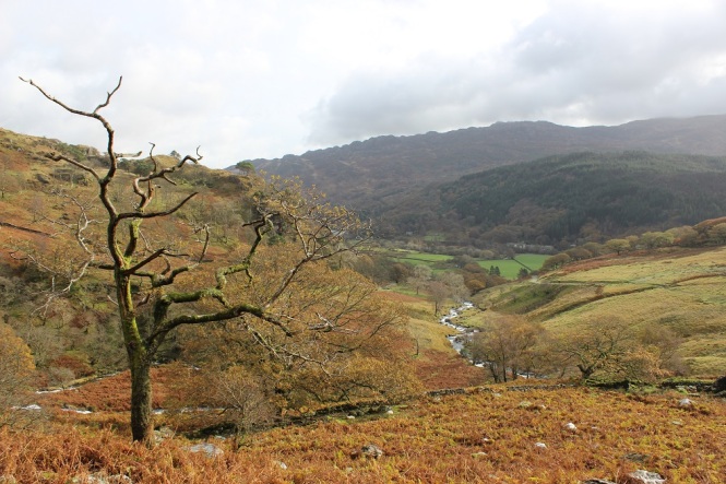
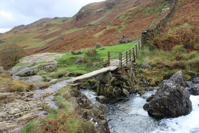
Eventually, our path led us to a gate and passing through, we found ourselves on a wide stone path which fell away on the right to the stream below us. Looking back we could see our potential route back, entirely dependent on whether we felt brave enough to cross the slate footbridge crossing the stream below.

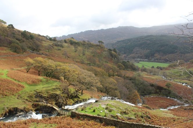
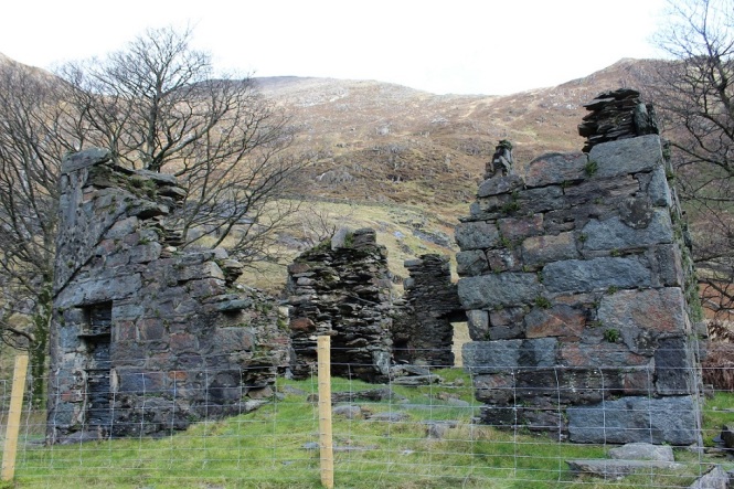
The more we walked, the more I came to think that maybe our plan B was the better choice. It was not too busy, certainly when compared to what I imagine the Miner’s Track was like judging by the number of cars that were in the area. Ahead and behind us were amazing views and we were truly spoilt with the weather. We hadn’t walked far, but really felt like we were exploring the mountains. And there were slate works coming into view.


A slate building was set amongst a spectacular water fall, white water crashing down after the heavy rain of the previous days. We climbed down to take a closer look, being carefully to make sure Rowan didn’t go too close to the edge.


The wide path began to level out now and our adventure leader, slightly driven by his stomach, led the way across a bridge and past some more slate buildings, looking for a suitable place for us to have a picnic.


We could see a rocky outcrop ahead and decided it would be the perfect spot for dinner, so leaving the footpath, we crossed some very soggy ground, including swinging Rowan across a small stream to reach the shallower back of the outcrop. As we reached the top we saw that had we carried on the footpath we could have easily reached our picnic spot from the other side. But nevermind – we had fun.
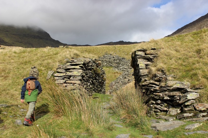
We ate our lunch in the sunshine and decided whether continue on. We were doing an out and back route so we had to work out how far to go whilst keeping enough energy in Rowan’s legs to get back. The boy was keen to continue, so we made our way back to the path where there were stones for the boy to collect, old building remains to explore and rock slabs to marvel at.


The path began to climb again, leading to more ruined slate works buildings, the remains of South Snowdon Slate Quarry. It is an interesting place to look around as there are many buildings, ruins and inclines to explore.


We climbed a little higher, but the path was becoming much steeper. At this point we had walked just over two miles, so we decided that this would be a good spot to call it a day and head back down. But not before a little more rock climbing.


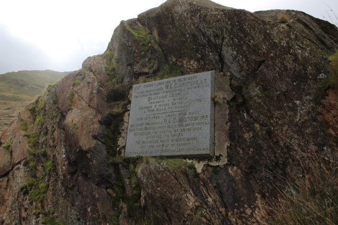
Quite often, we plan circular routes so we are not covering the same ground twice, but the beauty of an out and back route is that we get to see the things that we missed on the way up. This time, for us, it was the Gladstone Rock. The Watkin Path was opened by then Prime Minister William Gladstone, who addressed 2000 people from the mound that we ate our dinner on. The route down revealed the plaque we had missed by when we climbing the rock.
We continued on the same route back until we reached the large gate where at the bottom of a steep slope was the slate footbridge we had spied early. Clambering down, we arrived at the bridge which was about two feet wide, with no handrail and with Afon Cwm Llan about eight feet below.
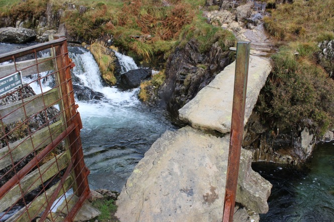
It looked like a tricky prospect, especially with two spaniels, but Rowan was desperate to cross the bridge so the boy and I walked across in single file with me holding Rowan’s hands in case of any slipping. Rick crossed with the dogs who were eager to come straight across now Rowan and I were on the opposite side. Rowan was very pleased with himself, and the view from the other side showed exactly how the bridge was built – two large slate slabs lying across another on its side. I wonder how long it has been there for?
From here, it was a pleasant walk across some fields, which were lovely and soft underfoot after being on rocks all day. We crossed a bridge and walked past some National Trust buildings until met up with the single track road from the start of the walk.


The weather, scenery and ruins to explore all came together to ensure we had a brilliant day on our plan B walk. We walked around four and a half miles, taking four and a half hours. If you are interested in this walk, you can find the route here.


This looks so lovely. I really enjoy reading about other people’s walks as it reminds me that I need to keep getting out and exploring the great outdoors! #adventurecalling
LikeLiked by 1 person
Aw, thanks for reading. I’m the same. You can get so many ideas from other people’s adventures. We chose to you to Arran for our honeymoon after reading a blog. We would never have thought about it otherwise, and we really fell in love with the place.
LikeLike
Wjat a plan B! The Watkin Path is my fave path up to the summit bar the full horseshoe circuit. It’s such a quiet, picturesque route – I’m glad most people head up the Pyg haha. Thanks for joining us on #adventurecalling. We’re open again for new posts in the morning.
LikeLiked by 1 person
It was gorgeous. I’ve only ever walked Snowdon from Pen y Pass, and I’m with you – it’s so peaceful and lovely.
LikeLiked by 1 person
I think your plan B was the best choice. Love your photos with all the autumnal colours, looks like you all had a brilliant walk, an didn’t have to fight the crowds. Thank you so much for sharing with us #AdventureCalling
LikeLiked by 1 person
Aw, thank you. You’re definitely right. It was lovely. Good wander for little legs too.
LikeLike