
At the end of August, I was really excited to be out in the Lakes with my lovely friend Kathryn again. Back before our children arrived, we had volunteered with Fix the Fells together, regularly making the journey up the M6 to spend the day with brilliant, passionate people repairing or maintaining the upland paths. (You can find out more about the great work they do here.) This time, our destination was Kentmere, to try and tackle the “more challenging than we had walked in ages” Kentmere Round.
We set off early as parking in Kentmere is very limited. Leaving Manchester around 7:20, we arrived just before 9 o’clock, taking one of the last parking spaces in a field, sometimes open to the public for parking (details here). We got our gear together and donned our rucksacks. The previous day I had taken Rowan trampolining – something nice and gentle to keep me fresh for the big walk, or so I thought. I’d possibly been bouncing a little over enthusiastically and had managed to hurt my back to the point where bouncing was no longer an option, and even sitting was painful later that night. Thankfully, it was feeling much better and my rucksack felt great – almost like a back brace pushing everything back into place. Who knew trampolining could be such hard work! We turned left out the field and followed the road past St Cuthbert’s Church. With the cloud hanging low on the fells, we wondered what sort of day was in store for us.
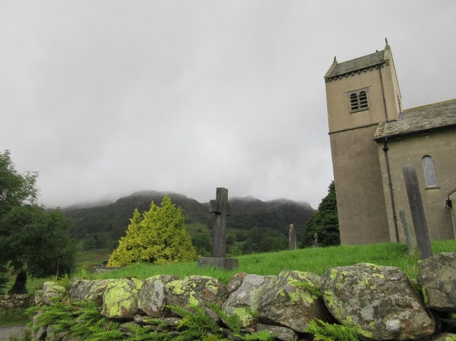
After about half a mile, the road gave way to a stony track, gently climbing out of Kentmere and into the hills. To the left, in a field, we spotted the Badger Stone, a huge boulder fallen from the hills above. Now used by climbers, it was looking good with its heather hair. It was great to be outside, making our way into the hills, whatever the weather was going to be.


Our bracken lined path rose steadily up the hillside, easing us gently into the walk. Not that you’d think that on hearing my heavy breathing. About a mile up this track, we spotted some crags off to our right, with some walkers slogging their way up the grassy slope between them. We consulted the map, and with some relief, we concluded that our path bore round to the left and the Garburn Pass. Some sheep watched us as we passed through a gate in a dry stone wall – they were clearly in love, and what a place to relax watching the world go by.


The Garburn Pass links Kentmere and Troutbeck, but we would not be heading that far. Following the line of a wall, we quickly came to a path on our right and a glimpse of the summit ahead. We were two miles in, had climbed around 320 metres and were feeling good. The cloud still rolled in and out, but our spirits were high as we tramped across the path which, slightly muddy in places and gravel in others, climbed gently until it reached a wall.


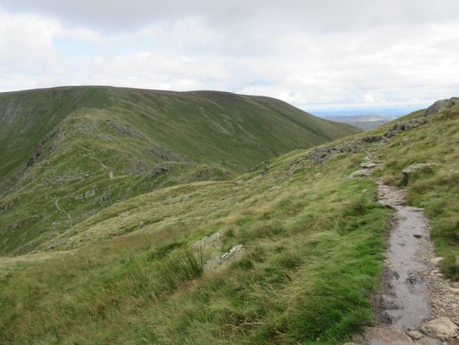
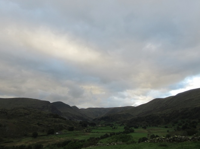
Passing through a gate and looking back down the path from which we had travelled we could see pockets of sunshine lighting up patches of grass in the distance – maybe the weather was going to clear. Ahead of us, the path steepened to what we found to be a false summit.


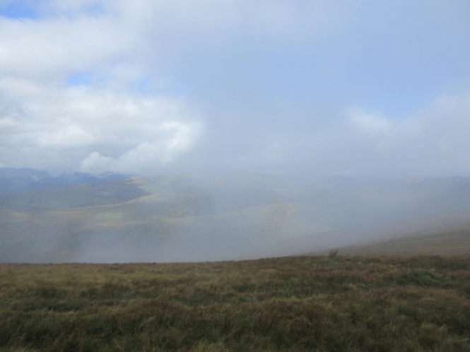
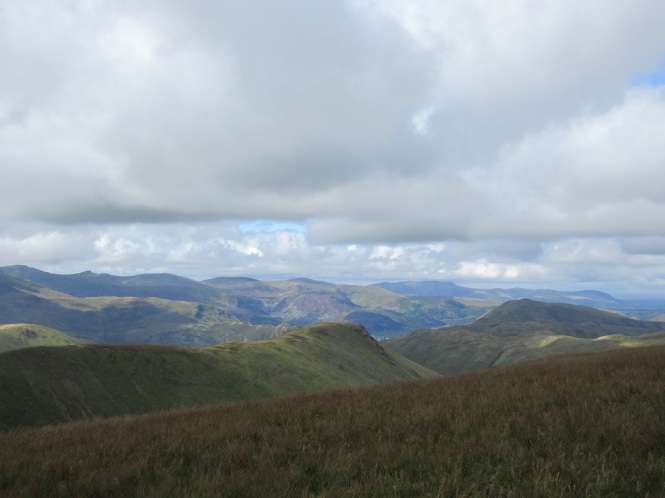
As we gained more height, we looked back to find Lake Windermere through the cloud whilst continuing onwards, a gravel path led through the mist to the actual summit.


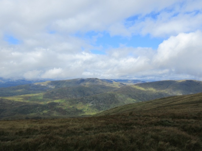
The pictures below were taken about two minutes apart. One minute we are walking through the mist, then a couple of minutes later, surprise! Gorgeous view across the fells with Red Screes in the distance.
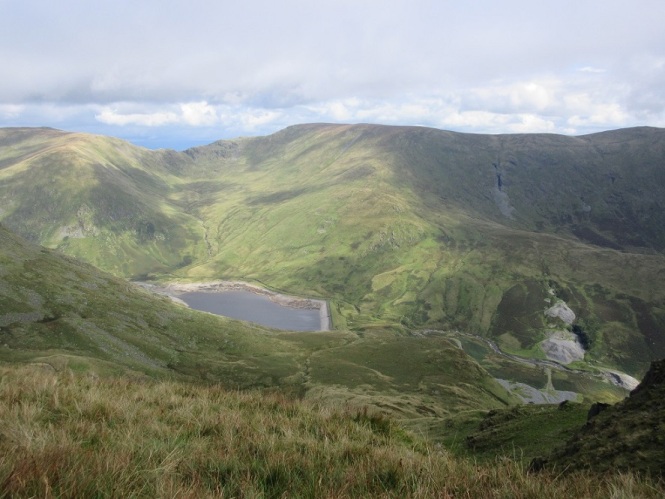
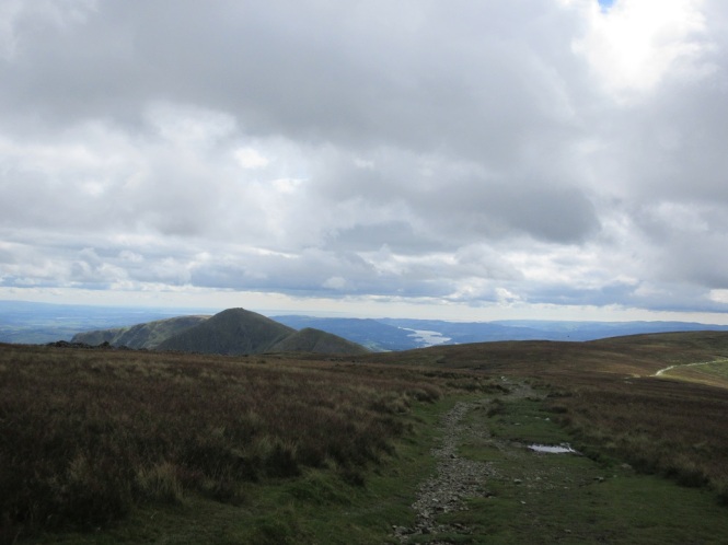
Just under a couple of hours after setting off from the car park, we reached our first summit. At 706 metres, Yoke was the first of the Wainwrights we were to bag that day, and from our viewpoint, we could see a few more of the summits we were going to visit. Looking down, we could see Kentmere Reservoir, built in 1848 to provide the mills of the village with a regular, reliable source of water. We could also see the dip of the Nan Bield pass – our get out point if we were feeling too tired when we reached it.


After a bite to eat and a quick call home to let Rick know we were safely on our walk, where I was told I needed to get a wriggle on if I was going to do another seven summits, we strolled along a well-made gravel path to what was going to be my favourite summit of the day.
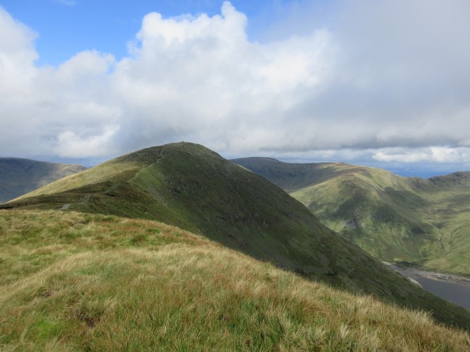
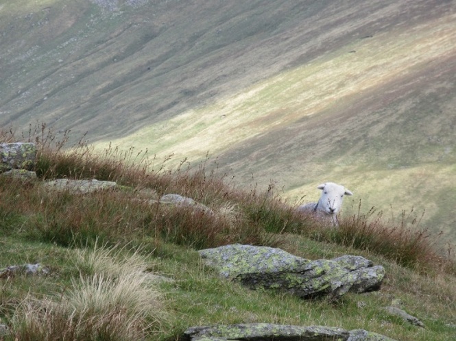
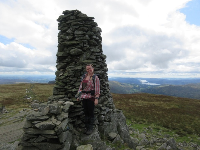
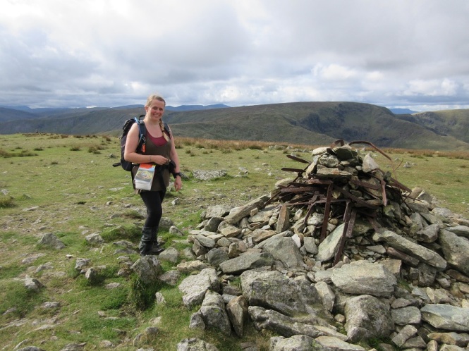
The descent and re-ascent here were not too much – only around 50 metres – so we were soon standing on summit number two, Ill Bell. I think the reason I fell in love with this peak was because it felt like a proper mountain top, with its steep sides and small summit area – much like the Langdale Pikes, Pike o’Blisco and Mount Doom. Add to this the imposing summit cairns which made me wonder about the history of this top, inventing stories to do with people making the journey to the mountain for solstice or full moons, or maybe a look out point. I think I’ve said before that that being in the outdoors can really spark the imagination, and this is certainly one of those places. And to top it all, even a little Herdwick popped up to say hello.


Much as I’d have loved to, we couldn’t linger here all day, so we made our way down the path onto the ridge that would lead us to Froswick. The climb down here was much steeper than that from Yoke, and with steep crag down to Kentmere, we took care with our footsteps. Once down, the path was easy walking, with Froswick looming and Thornthwaite Crag to be seen in the distance. Looking back, the craggy Kentmere side of Ill Bell could be seen.
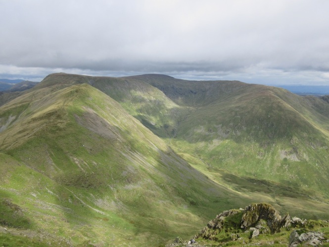
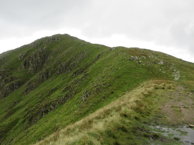
The descent and ascent this time was about 100 metres, so it took a little longer to get to the third fell of Froswick, but when we did we found a small summit cairn with view back to “my Ill Bell” – one of the pillars clearly visible on the top. You could also see that the path from Ill Bell to Froswick wasn’t one to stray from in the mist. Looking towards Thornthwaite Crag we could see that it was a bit further to reach our fourth Wainwright of the day. We could also see the profile of the path to Stoney Cove Pike – one of our potential add on fells. (Look past the idiot posing on the top to the left of the picture for the path). It was at this point we decide to save that one for another day.


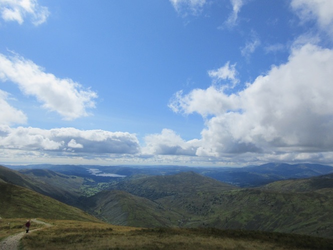
There were 100 metres of descent and 150 metres of ascent and about a mile between us and our next peak. Along the way we encountered false summits and glorious views down each side of the ridge, one side revealing Windermere and the other Kentmere Reservoir. The mist and rolling cloud had cleared and we were left with sunshine, blues skies and cloud level above the tops – a perfect day.
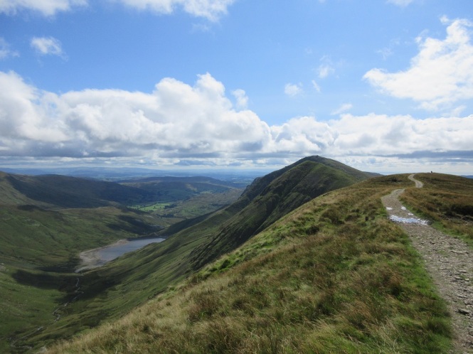
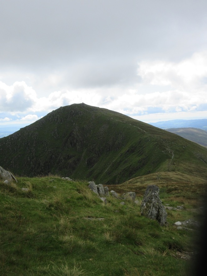
At the top of the false summit, we could look back to see along the whole ridge we had just covered, Ill Bell standing tall in the middle. Onwards, there was no mistaking the Thornthwaite Crag and its huge beacon.


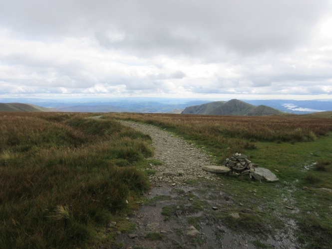
Having a bit more to eat on Thornthwaite Crag, we decided what route to take next. We had been out for over four and a half hours at this point, covered six miles, but still had about the same to go. Seeing the climb to Stoney Cove Pike, and hearing the breathless people who had just visited it only confirmed our earlier thoughts – this was one for another day. High Street, however, would only increase our walk by about a mile in distance, and the climb was a gentle 70 metres. We decided to add it to the eight hills we were already planning to climb.
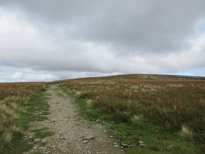
We left Thornthwaite Crag, its glorious views and comfortable wall and strolled down to the plateau at the head of the Kentmere valley. The convergence of paths here meant saw lots of people out enjoying their day. Our path took us left along the route of the Roman road. This road joined the Roman forts at Brougham near Penrith with Ambleside – the broad flat top was considered much safer to travel as the marshy, densely forested valley floors were considered more susceptible to ambushes. I found it fascinating to be walking in the footsteps of Roman soldiers all those centuries ago. I also found it boggy in places and much further than it had seemed on the map.
Looking to the left we spotted glimpses of Hayeswater, The Knott and Rest Dodd
Ahead we caught sight of Blencathra across the gorgeous hilly landscape.
And behind us Windermere, Morecambe Bay and the perfect summit and lovely cairns of Ill Bell. One of the things I found so wonderful about this walk was that we started in the south of the Lake District, yet here we were, admiring Blencathra, one of the most northern fells.
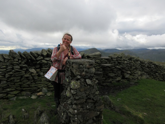
Eventually, on the broad, level, grassy summit, marched over by Roman soldiers before we arrived here, we could see the High Street trig point – a concrete pillar nearly as tall as me. We had been walking for five hours, covering nearly seven miles and were standing at 828 metres. We had visited five Wainwrights and it felt like an achievement, but we still had more to do.


Leaving High Street, we followed the wall back, this time on the opposite side as we were looking out for a path going off to the left. I was able to admire Ill Bell some more until we came to a cairn marking the well-defined path we were going to take to our sixth Wainwright, Mardale Ill Bell.
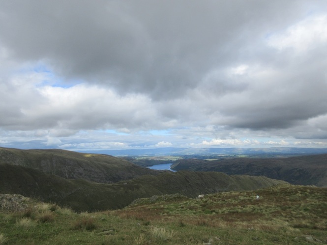
It was an easy stroll down to Mardale Ill Bell, a less interesting summit than my Ill Bell, but with lovely views over Haweswater Reservoir. Built in 1929, this reservoir now supplies around 25% of the North West’s water supply.


We continued along the path until we saw it – the huge descent and re-ascent ahead of us. It was about 120 metres down and then back up again, but it looked like so much more, possibly because it was the steepest section of the day.
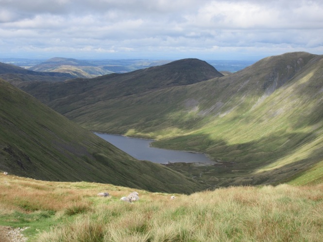
Our route was to take us to the Nan Bield Pass where, if we wanted, we could head down the Kentmere valley and back to the car, cutting the walk shorter, but I think we both knew we weren’t going to do that. Looking around, the views were as glorious as they had been all day long. To our left was Small Water and Haweswater Reservoir, and glancing behind us, the ridge we had walked along earlier in the day, looking dark and imposing against the sunlight lit clouds.


Before long, we were at the Nan Bield Pass and rather than stopping for a sit down at the impressive shelter, we pressed on up the steep climb to the top of Harter Fell. Some of the steps up here were quite big for my little legs and hands were required in a couple of places. The path was possibly a little exposed for some at one section, but it was over almost as soon as it started.


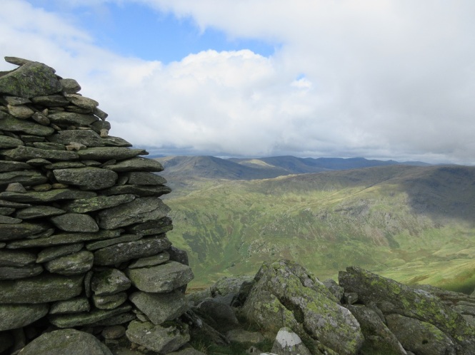
Once the steep section was completed, which incidentally, was easier than we expected, it was a short stroll across the grass towards a fence to find the summit of our seventh Wainwright of the day. Harter Fell, with its iron strewn cairn had views across to High Street in one direction, and in the other, the path along the fence line to our next target, just over a mile away.
This path was really wet underfoot, which certainly tested how waterproof my boots were (and I’m pleased to say that they still are). Being so soggy was probably a blessing in disguise as it was soft and much easier on the knees – something I have to consider more than I would like at times.
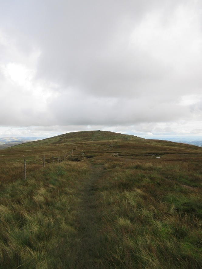
After just over half an hour, we reached the top of Kentmere Pike, our eighth Wainwright. We had been walking for eight and a half hours, covered nearly ten miles, and now had to climb the steps of the dry stone wall with wobbly legs to have our photos taken with the trig point. We both managed not to slip off, and as it was five o’clock, we decided to stop for another bite to eat, have a brew and phone home to let people now we were ok.
Rick remarked to me that we’d “better get a move on, daylight’s wasting”, which we thought was hilarious. We only had one more to do. We were nearly there. Plenty of daylight!
The remainder of our route followed a fence then wall all the way down to a track that would lead back to Kentmere village and the car, passing over the last Wainwright of the day, Shipman Knotts, along the way. The path looked easy enough and oh how we scoffed at the prospect of not being back to the car before it got dark. It was around this point however, that our legs really began to feel the days walking. Coupled with the boggy route and a really steep stile, it took much longer than we thought to get to Shipman Knotts.


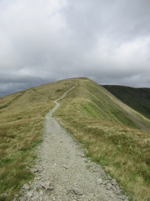
We got there though. We could see the village of Kentmere (it looked a long way away), and behind us we could see the fells we had walked that day. It felt good to have been out all day – our feet had walked the entire skyline in the photo below, and more.


Not long after leaving the summit though, teleportation was on my wish list. We had walked eleven miles, the path had steepened and tired legs were really feeling it. We had made the decision to stick by the wall and some parts of the descent required me to sit on my bum to reach to next footstep. We both found the last mile from Shipman Knotts to the track difficult, mostly due to being tired yet still having to concentrate on where we were putting our feet and the more rugged path requiring more energy.


But the track arrived, and with it, a renewed energy. It was 7 o’clock. Turns out daylight was wasting! From here it was a mile and a half back to the car passing a gorgeous view of the walk we had completed and lots of lovely animals. We walked around 13.5 miles and climbed 1,295 metres – and it was brilliant. We were tired but happy. What a day and what a walk! If you’re interested in this route, you can find a map here. And did I mention how much I loved Ill Bell.


Great walk, and some distance covered in one day with all that ascent. I haven’t done any of those yet on my list and I’m up to 110
LikeLiked by 1 person
It was a fab day out. Worth getting up early to park in Kentmere for.
110! You’re nearly half way there. I started again when I started this blog, so I’m at 13. A long way to go, but getting out there and enjoying those fells is well worth it!
LikeLike
We stayed a Maggs Howe BnB it was great and no problem parking the walk ends there and evening meal was ready for our late arrival back very welcome after 10 hours on the fells doing the horseshoe but worth especially in good weather ?!
LikeLiked by 1 person
That sounds perfect. I was very ready for food when we got back.
It’s a beautiful walk and we were really lucky with the weather. Definitely one to revisit.
LikeLike
The scenery is stunning, I have never been to the Lake district, my husband used to live in Keswick and often tells me about the amazing countryside #adventurecalling@_karendenbid199@gmail us
LikeLiked by 1 person
It’s really lovely. I really feel relaxed there. Hopefully you will get up there too 🙂
LikeLike
Sounds like a brilliant walk and an impressive amount of Wainwrights ticked off! It was lucky that the weather brightened up and you could get such amazing views across the Lake District. Your photos are fab, particularly the one with the little Herdwick poking his head out! Thanks for sharing #adventurecalling
LikeLiked by 1 person
It’s a fabulous walk. One for another visit for sure.
And thank you. I love the Herdwick. They are so photogenic with their little smiley faces. 🙂
LikeLike
This looks like a great hike. I love those moments when the mist clears to reveal great views. I really need to go back through m,y walk history so I can tick off the Wainwrights I’ve done and set myself a target list of those still to do. Thanks for joining us on #adventurecalling, we’re back open tonight for new posts.
LikeLiked by 1 person
I tried to do the same when I decided to start walking the Wainwrights, but I had kept no records and couldn’t remember exactly what I had done, so I just started again. It’s been great doing them though – you end up in places you might not have visited otherwise.
LikeLiked by 1 person